


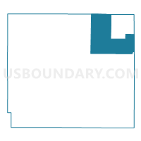
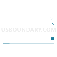
Lincoln Voting District, Crawford County, Kansas
About
Outline

Summary
| Unique Area Identifier | 584437 |
| Name | Lincoln Voting District |
| County | Crawford County |
| State | Kansas |
| Area (square miles) | 48.17 |
| Land Area (square miles) | 47.95 |
| Water Area (square miles) | 0.22 |
| % of Land Area | 99.54 |
| % of Water Area | 0.46 |
| Latitude of the Internal Point | 37.61492910 |
| Longtitude of the Internal Point | -94.71358180 |
Maps

Graphs
Select a template below for downloading or customizing gragh for Lincoln Voting District, Crawford County, Kansas


Neighbors
Neighoring Voting District (by Name) Neighboring Voting District on the Map
- Crowe Voting District, Crawford County, KS
- Drywood Township Voting District, Bourbon County, KS
- Leroy Voting District, Barton County, MO
- Lincoln-Arcadia Voting District, Crawford County, KS
- Mulberry Ward 1, Crawford County, KS
- Mulberry Ward 2, Crawford County, KS
- North Arma Voting District, Crawford County, KS
- Ozark Voting District, Barton County, MO
- Pawnee Township Voting District, Bourbon County, KS
- Raymond Voting District, Crawford County, KS
- Sherman Voting District, Crawford County, KS
Top 10 Neighboring County Subdivision (by Population) Neighboring County Subdivision on the Map
- Washington township, Crawford County, KS (3,501)
- Ozark township, Barton County, MO (1,078)
- Crawford township, Crawford County, KS (928)
- Lincoln township, Crawford County, KS (832)
- Sherman township, Crawford County, KS (536)
- Mulberry city, Crawford County, KS (520)
- Drywood township, Bourbon County, KS (409)
- Pawnee township, Bourbon County, KS (307)
- Leroy township, Barton County, MO (223)
Top 10 Neighboring Place (by Population) Neighboring Place on the Map
Top 10 Neighboring Unified School District (by Population) Neighboring Unified School District on the Map
- Fort Scott Unified School District 234, KS (12,660)
- Girard Unified School District 248, KS (5,480)
- Northeast Unified School District 246, KS (4,088)
- Liberal R-II School District, MO (2,982)
Top 10 Neighboring State Legislative District Lower Chamber (by Population) Neighboring State Legislative District Lower Chamber on the Map
- State House District 126, MO (36,895)
- State House District 4, KS (20,981)
- State House District 2, KS (20,299)
- State House District 8, KS (20,232)
Top 10 Neighboring State Legislative District Upper Chamber (by Population) Neighboring State Legislative District Upper Chamber on the Map
Top 10 Neighboring 111th Congressional District (by Population) Neighboring 111th Congressional District on the Map
Top 10 Neighboring Census Tract (by Population) Neighboring Census Tract on the Map
- Census Tract 9566, Crawford County, KS (4,232)
- Census Tract 9602, Barton County, MO (4,104)
- Census Tract 9567, Crawford County, KS (3,727)
- Census Tract 9557, Bourbon County, KS (2,332)
Top 10 Neighboring 5-Digit ZIP Code Tabulation Area (by Population) Neighboring 5-Digit ZIP Code Tabulation Area on the Map
- 66701, KS (12,325)
- 66743, KS (4,373)
- 66712, KS (1,939)
- 64762, MO (1,604)
- 66756, KS (1,007)
- 64769, MO (611)
- 66711, KS (610)
- 66734, KS (332)